Olveston Parish
Olveston is a parish that comprises two villages, Olveston and Tockington, and four hamlets, Old Down, Awkley, Lower Hazel and Ingst. Its boundaries have contracted through the centuries, allowing adjoining parishes to expand; the last two changes occurred in 1935 and 1988. Early occupation of the area took place at the fringe of the marshland abutting the River Severn. There is evidence that, since the Iron Age, there was occupation on the higher ground that rises up to 200 feet above the river level. Such evidence of occupation in the Iron and Roman periods still exists in the parish. With the drainage of the marshland and the creation of a tide-restraining sea wall at the river bank, significant dwellings were erected from the 12th century.
The parish lay within what was the Langley and Swinehead Hundred, to comprise the tithing of Olveston and tithing of Upper and Lower Tockington and two Manors, that of Olveston and Tockington.
The parish church of St Mary the Virgin, built in the 12th century and enlarged in the 14th, was controlled by Bath Abbey, then Worcester and finally by the Bristol Diocese. Non-conformism commenced with the Quakers in 1654, to be followed with Methodism in the early 1800s.
Agriculture was the primary occupation with its allied trades. Good quality carboniferous limestone existed and was quarried for the building of all the local dwellings. As a result of the Second World War, agriculture became mechanised requiring less labour and, with the availability of a bus service to Bristol and affordable motor cars, employment moved out of the parish into other occupations, chiefly at the Bristol Aeroplane Company at Filton and Patchway where, at its peak, over 52,000 were employed.
From the Roman period onwards, travellers passed through Olveston and Tockington when using the ferry service at Aust to cross the River Severn, until 1966 when a suspension bridge was constructed, together with a motorway connecting London to South Wales. The motorway bypassed the two villages and in 1996 a spur motorway was added, leading to a second Severn bridge to the south of the parish.
The Church Vestry administered the parish until the Local Government Act of 1894 which introduced County and Parish Councils. Education for the young had been available in Olveston since 1604, when a school was established; the present primary school has been in existence since 1836. All of the remaining Commons and wastelands were enclosed in 1844.
The population in 1700 was 230, rising to a peak in 1881 of 1750 due to the construction of the nearby railways. Mains water came to Olveston and Tockington by 1900 and Tockington received electricity from a generator in Almondsbury in 1920, with Olveston receiving supply from Bristol ten years later. By 1935 the population had dropped to 1220 as a result of parish boundary contraction and, in the mid 1950s, the whole parish was connected to mains water and electricity, resulting from an Act of Parliament for service connections to all farms in order to increase milk production. In the mid 1960s, as a direct result of the installation of mains sewerage, a major house-building programme resulted in the population increasing to 2520 but the further parish boundary contraction of 1988 caused a decrease to 2045.
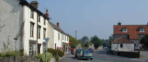
Today, much of the agriculture and its buildings are being dismantled, with many converted into dwellings or light industrial uses. The number of milking farms in the parish can now be counted on one hand. There were many shops within Olveston, Tockington and Old Down; the decline began in 1942 with sweet rationing and has since been progressive. Now only two shops remain in Olveston, together with one inn, there being further inns in Tockington and Old Down.
There are village connections with OLveston House in the suburbs of Dunedin, New Zealand, and Olveston, Montserrat, in th eWest Indies. You can access the website for Olveston House here.
The Parish of Olveston Design Statement:
This illustrated document has been produced by a group within the Parish to identify the significant features of the area, in the expectation that it will be employed as guidance by South Gloucestershire Council in planning matters. The photo below, and several of the photos in the headline banner above, originate from the Olveston Parish Design Statement, which shows the parish in marvellously illustrated detail.You can read the statement here.